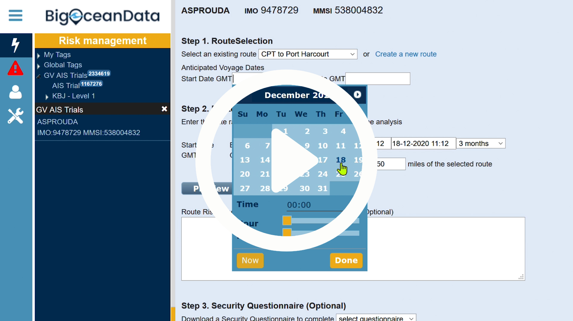
Vessel Risk Management
Category: Vessel Tracking Tools
BigOceanData’s Vessel Risk Management package produces a Risk Assessment document per vessel. For an identified vessel, it assesses the scheduled Vessel Route against historic piracy incidents. The Risk Assessment can be extended to include a Vessel Questionnaire (the example shown is based on the BMP MSCHOA Vessel registration document, but this questionnaire template is user…
Fleet Speed Analysis
Category: Vessel Tracking Tools
Customised Tracking Solutions; Just one of the many features available with our Customised Tracking Software Solutions. Analyse vessel speed along its journey for one or more vessels, with your own White Labelled version of BigOceanData.
Vessel Reports
Category: Vessel Tracking Tools
Vessel & Fleet Reports – Tap into BigOceanData’s knowledge base and extract data in a number of differently formatted Reports. These reports can be generated at an individual Vessel level, or Fleet level and most of these are exportable.
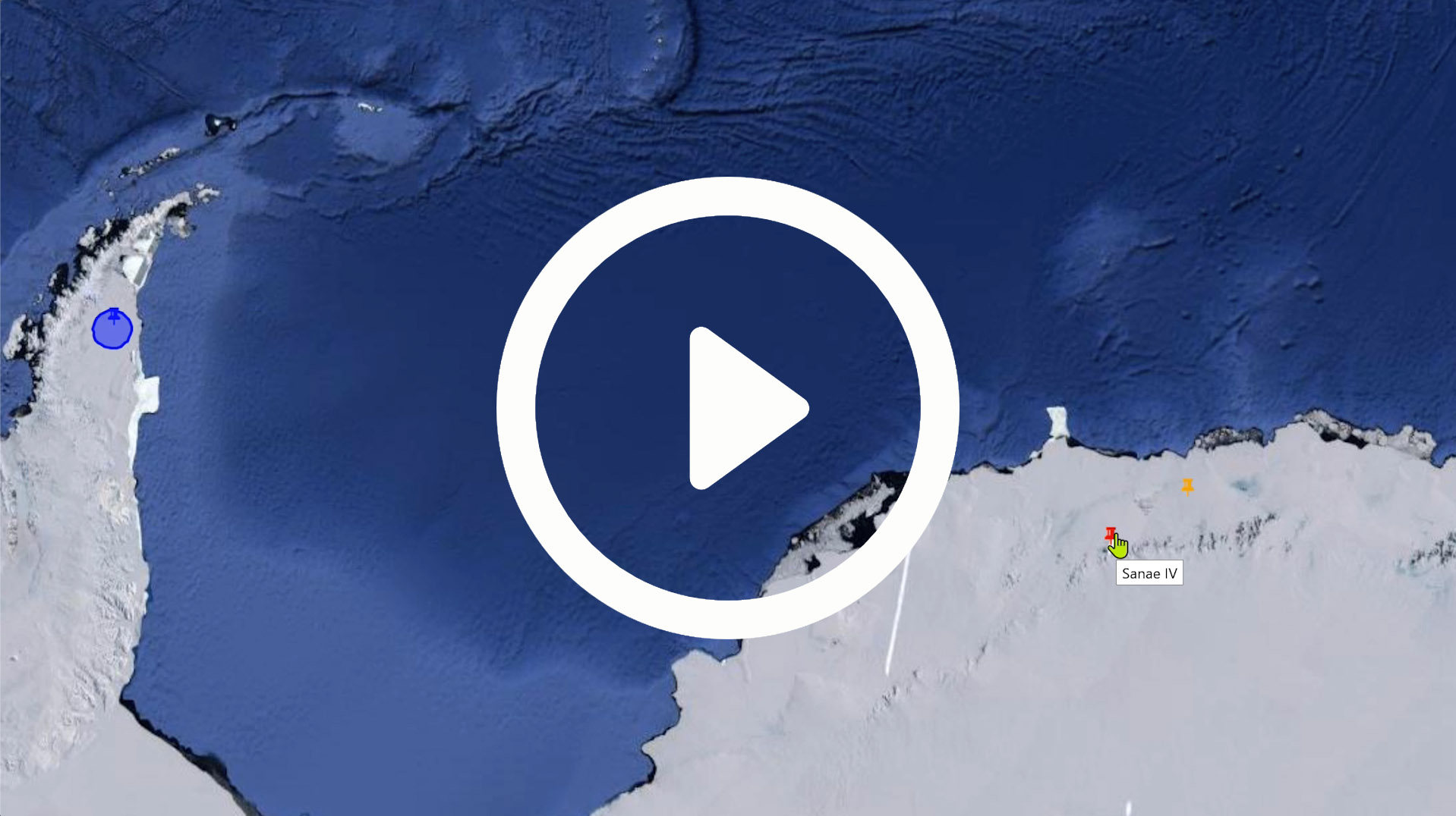
Points of Interest
Category: Vessel Tracking Tools
Use Points of Interest to create and maintain various types or categories of Points of Interest. These can have different symbols, colour coded to uniquely display data which is core to your operation.
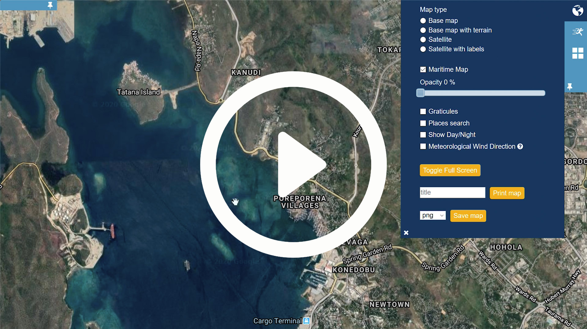
Chart Schemes – Mapping and View Ports
Category: Vessel Tracking Tools
Chart Schemes – Explore the seamless integration of maritime charts within a global tiled mapping system. This tool allows you to define up to 5 saved View-Ports per user to quickly navigate between favourite areas.
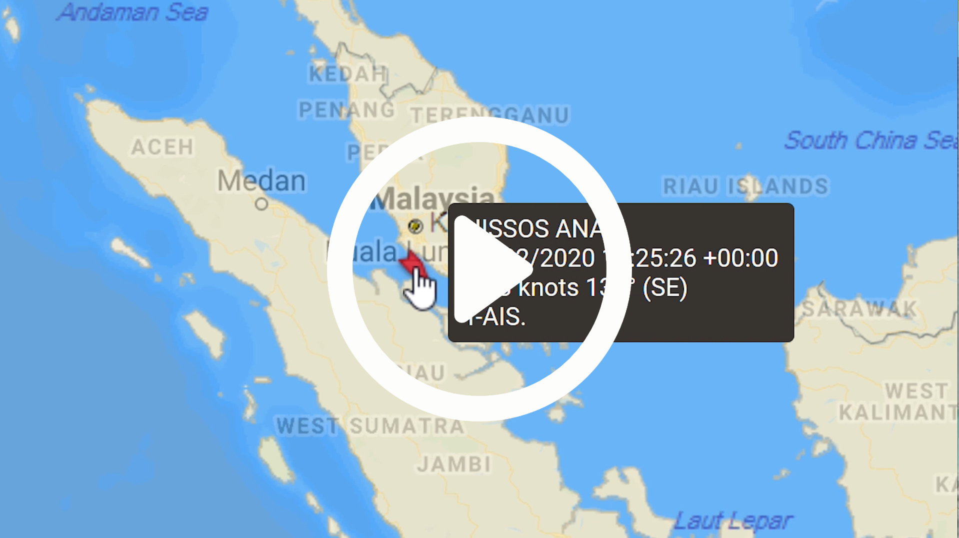
Vessel Tracking – Combining Vessel Position Sources
Category: Vessel Tracking Tools
AIS Vessel Tracking – Display and analyse the historic vessel trail from AIS or other available position sources for your subscribed vessels
Vessel Tracking – AIS Latest Global Positions
Category: Vessel Tracking Tools
View the latest vessel position received from AIS sources for vessels globally
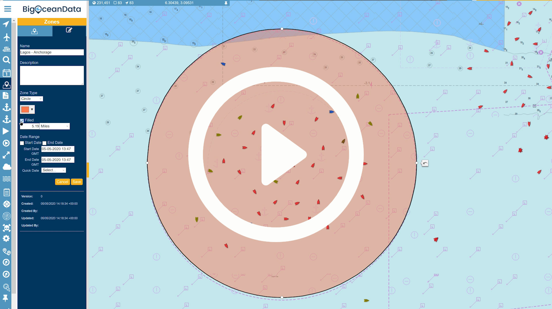
Zones
Category: Vessel Tracking Tools
The BigOceanData ship tracking Zone manager tool can be used to create and maintain polygon or circular zones – colour coded as required.
Port Activity Dashboard
Category: Vessel Tracking Tools
Our Port Activity Dashboard tool allows users to select a Port and see what vessels are due to arrive.
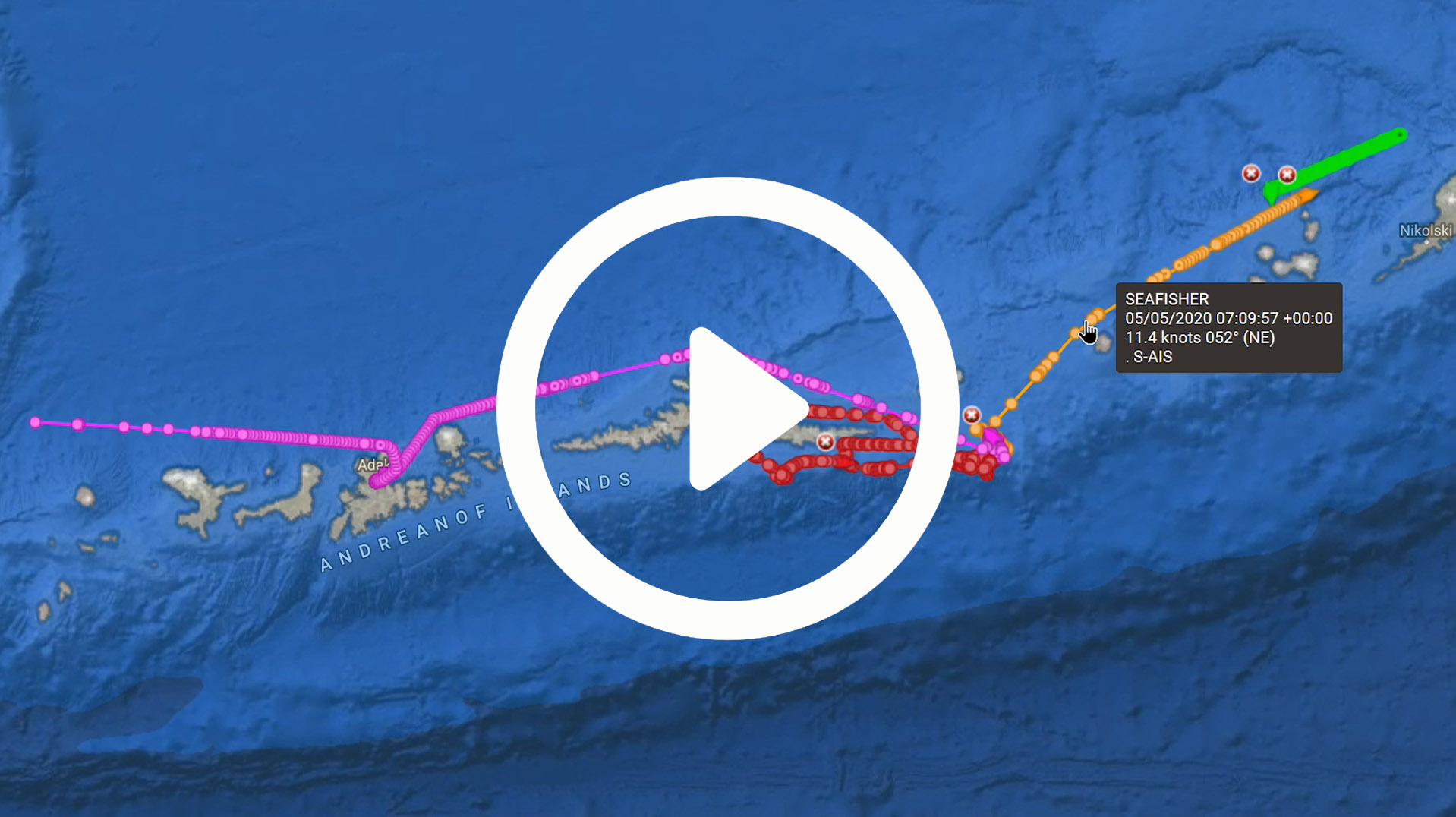
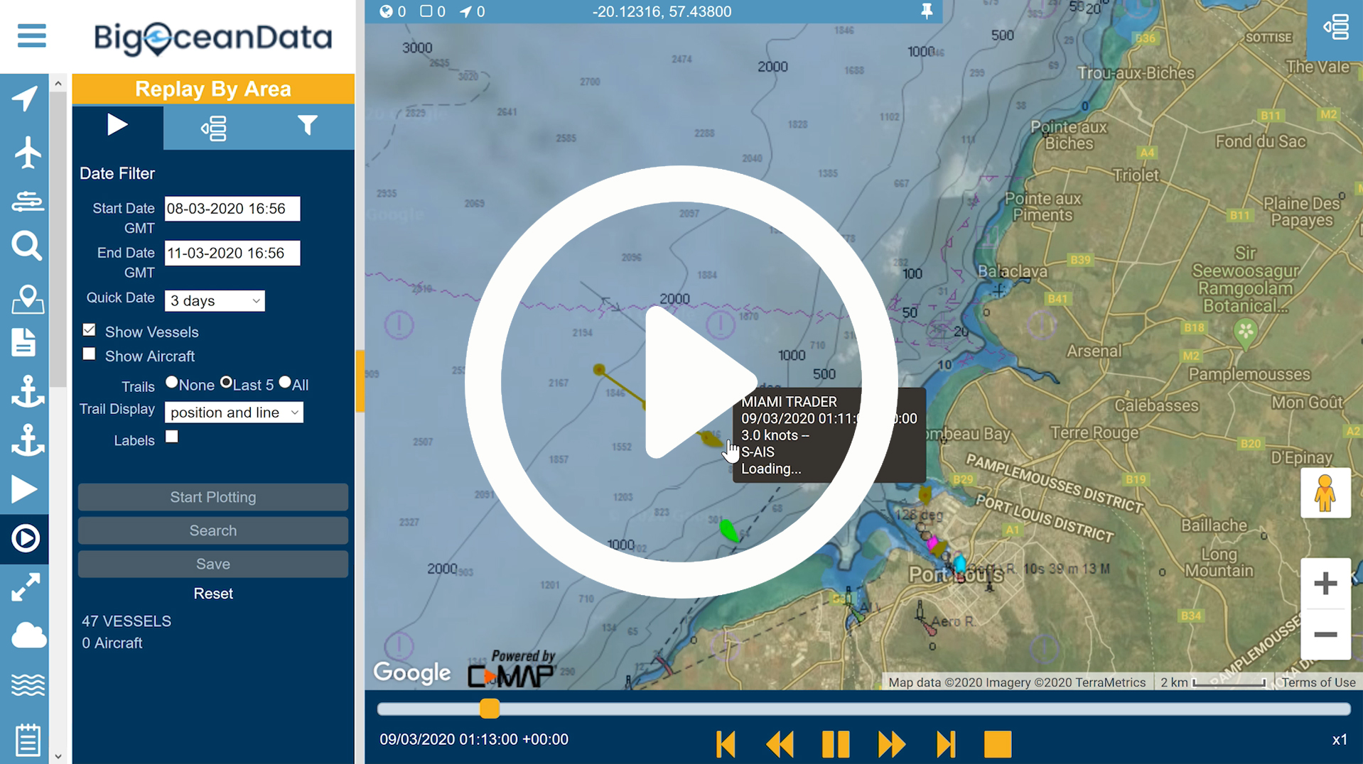
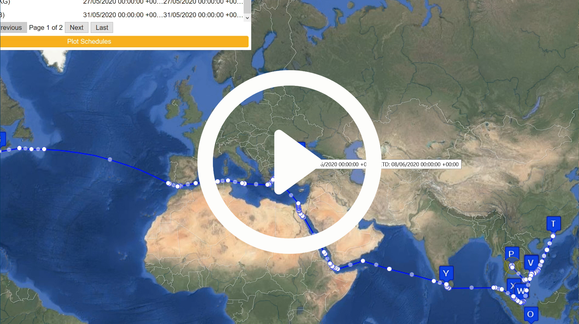
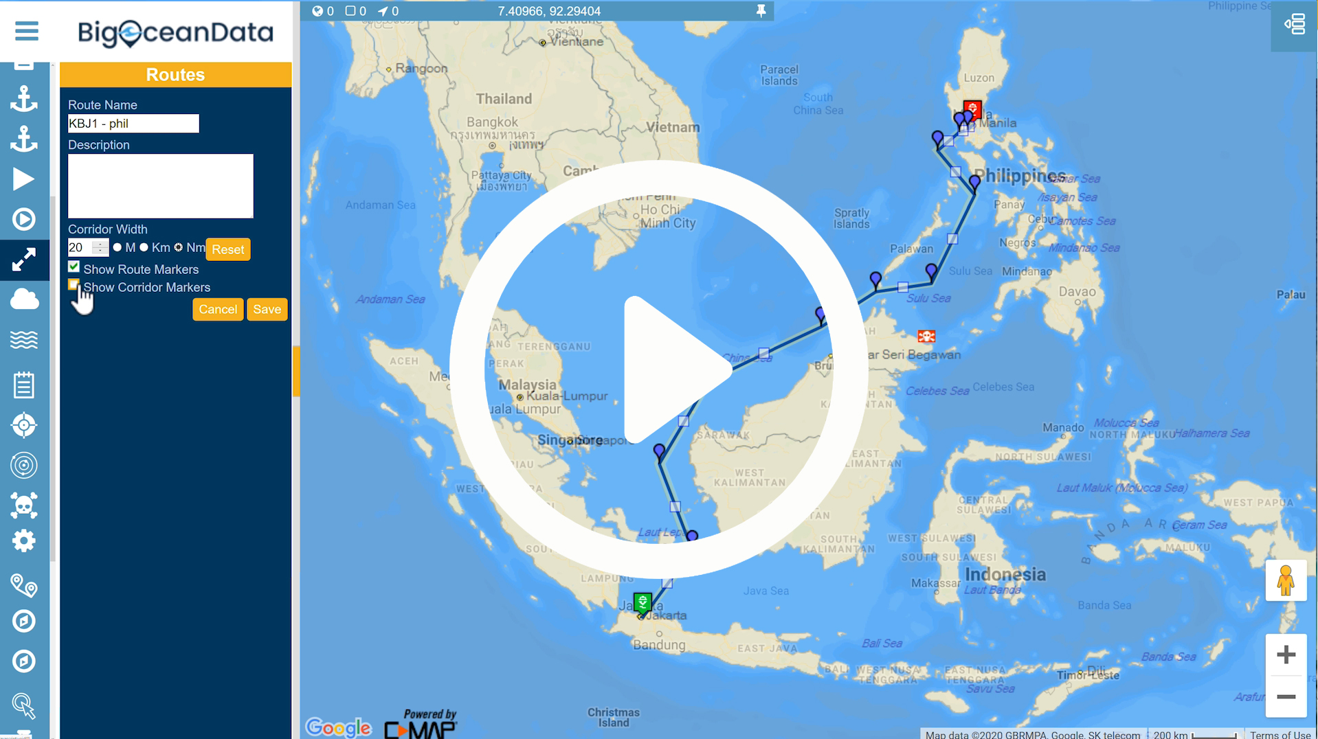
Trails – Multiple Vessel Plotting
Category: Vessel Tracking Tools
Whilst some ship tracking software only lets you plot a single vessel track, with BigOceanData you can plot multiple vessel tracks at the same time,
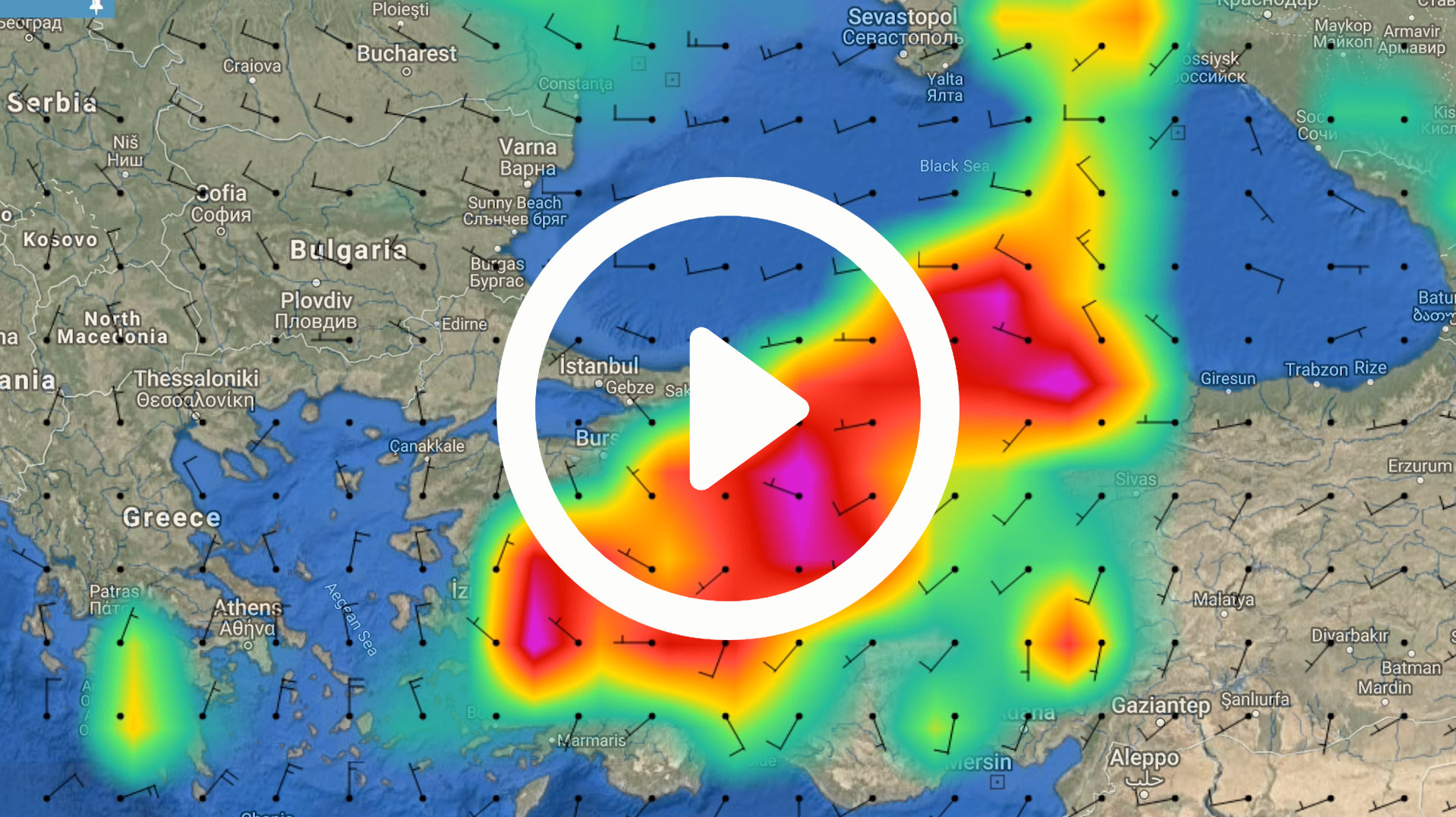
Weather – Global 5 day forecast
Category: Vessel Tracking Tools
Weather – This tool provides a global weather forecast for the next 5 days, plus historic spot weather forecast data for analytic investigations.
Cargo Schedules – Single Vessel
Category: Vessel Tracking Tools
Cargo Schedules – Single Vessel. Identify which Ports a specific cargo vessel is due to visit and when.
Cargo Schedules – Single Port Activity
Category: Vessel Tracking Tools
Cargo Schedules – Single Port Activity. Identify which vessels are scheduled to visit a specific port.
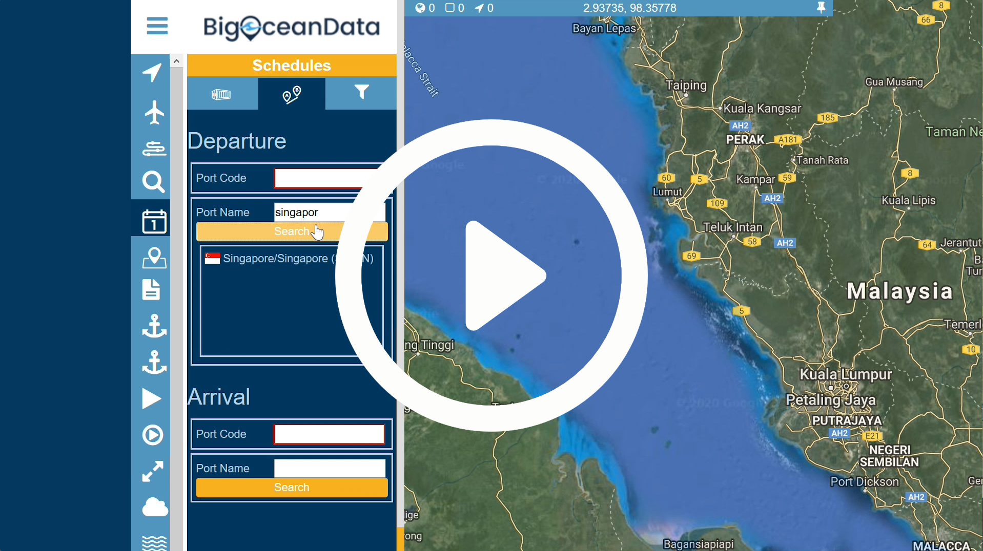
Cargo Schedules – Port to Port
Category: Vessel Tracking Tools
Cargo Schedules – Port to Port. Identify which vessels have sailing schedules between two Ports
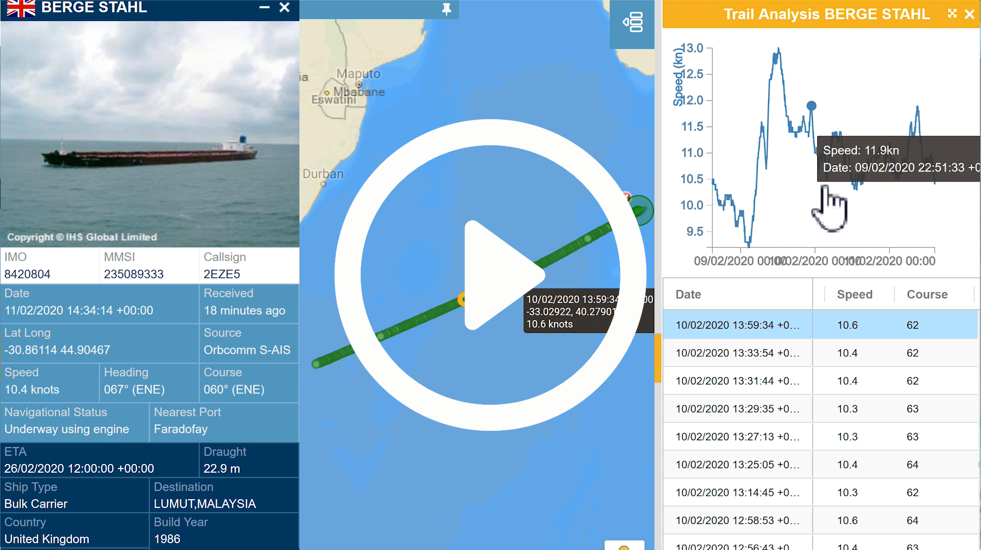
Trails – Vessel Speed Analysis
Category: Vessel Tracking Tools
One measure of efficiency is to monitor vessels speed and how it varies en route.
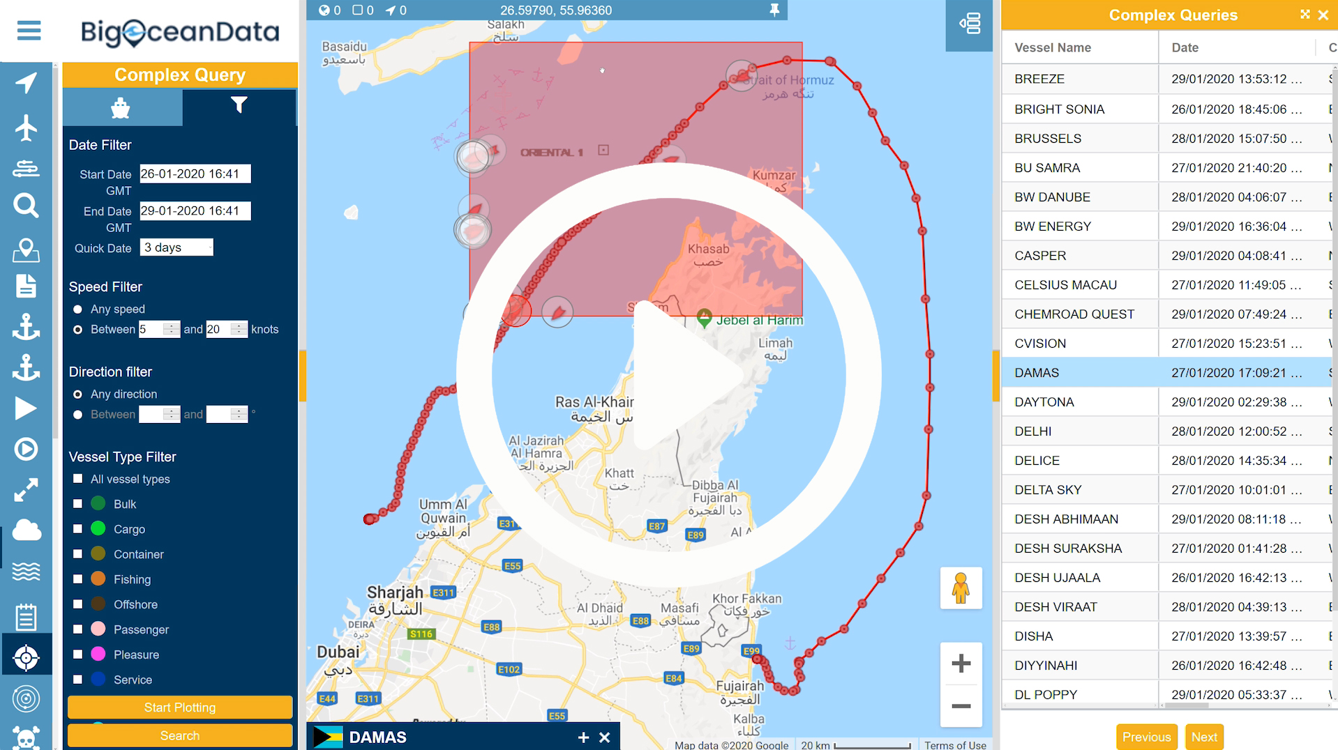
Piracy and Routes – Risk Management
Category: Vessel Tracking Tools
BigOceanData has a live feed of confirmed Piracy incidents worldwide. These are categorised by severity and can be filtered, by age.
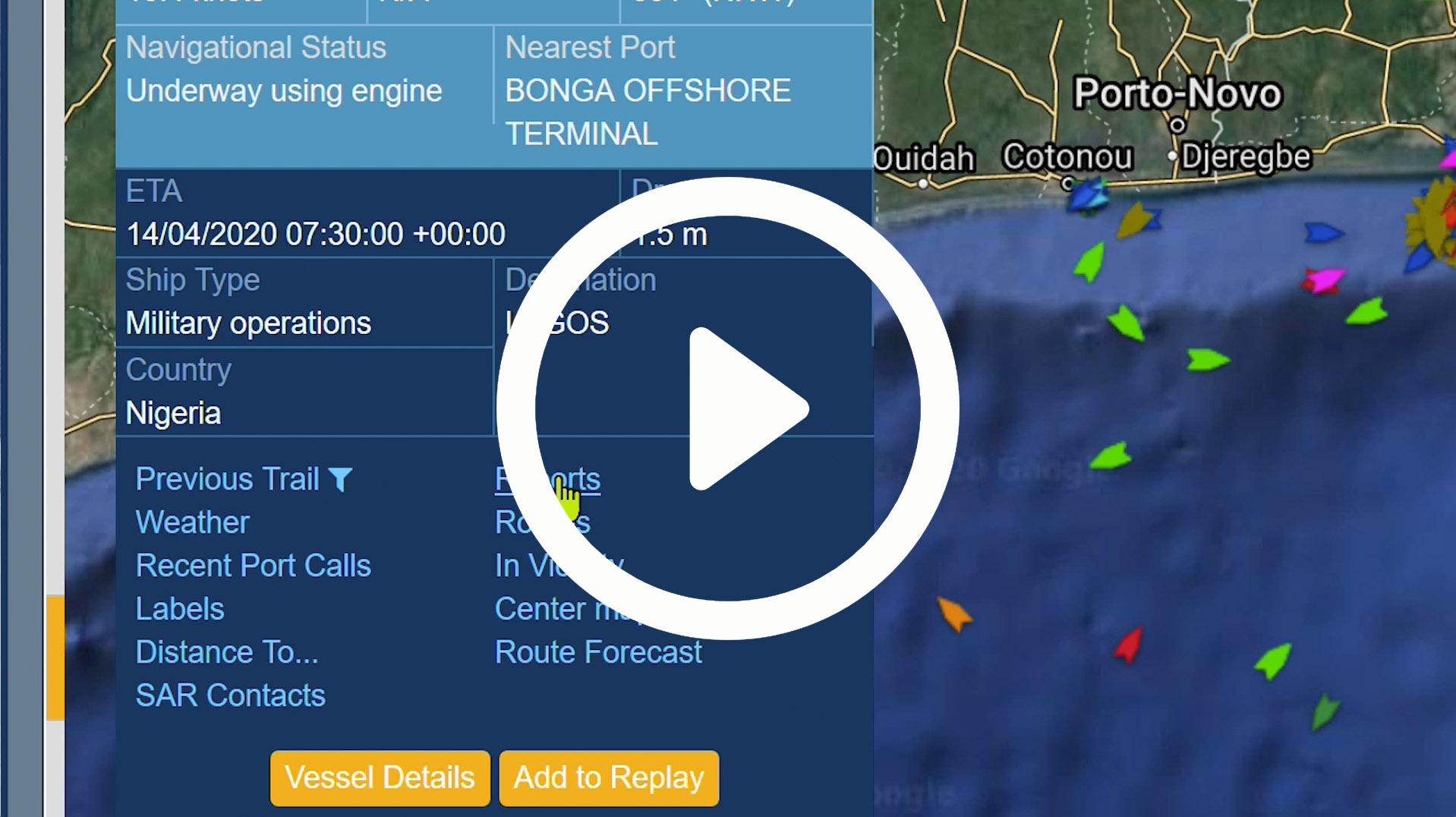
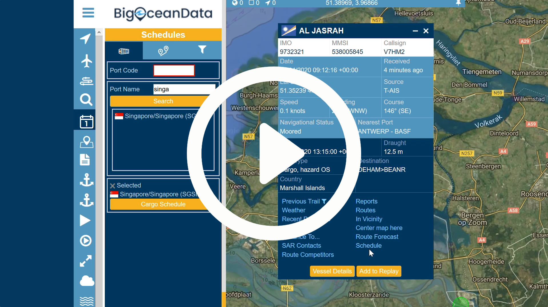
Tracking – Vessel Details, ETA & Calculated ETA
Category: Vessel Tracking Tools
If you really want the best available ETA of a vessel, based on its current location and distance to travel, use BigOceanData to select a vessel, and on the Vessel Details panel, identify its current location, it’s next Port and published ETA
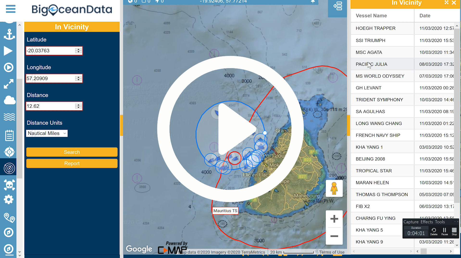
In Vicinity
Category: Vessel Tracking Tools
Need to know what vessels are currently near to a location, other vessel, piracy incident or bad weather?